The Compromise ALL GREEN SPACE SOUTH OF THE SERVICE ROAD BY THE LAKE SAVED!!!
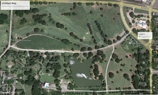
The Links at Audubon Park and Audubon Park as it exists now:
Audubon Links and the Park as it exists now from Cherry Road to Perkins Ext'd
The diagram of the proposed changes published 9/14/22 taking all of the green space on the east end of the park
The area of Park that will be taken marked in red beside the same area on the design diagram
At the October 20th meeting Nick Walker presented the below diagram (sorry for the poor quality, all we have is screen shot from TV as Parks refuses to share or post). Two holes still exist south of the service road. Walker characterized the minimal change as having been skinnied up. First diagram is zoomed to east area. Can you see much difference compared to diagram above?
Councilman Canale was quoted in the Oct. 20th Daily Memphian article as saying, "...you are talking about 30 unused acres and we are going to take eight of them." The below Google Earth measured photos show that taking in both the meadow above the service road and the meadow below that totals only 23.07 acres of which the new holes will take approximately 15 (based on Walkers statement that the holes south of the road occupy 8 acres).


